
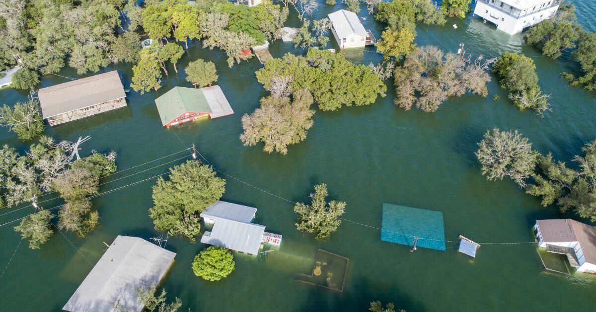
In a study spearheaded by Professor Manoochehr Shirzaei at Virginia Tech’s Earth Observation and Innovation Lab, researchers provide a grim forecast for coastal cities in the United States facing the threat of flooding. Disappearing Cities on US Coasts leverages highly accurate space-based radar measurements. Revealing an alarming future just 26 years ahead, with significant increases in land flooding, populations affected, and property damage.
Shirzaei states, “What we’ve done here is focused the picture on the short term, just 26 years from now.” The anticipated changes are staggering:
Shirzaei emphasizes that the study’s primary goal is to arm city and county officials with comprehensive data to inform flood resilience plans, which are mandated by law but may have been developed without the whole picture that this study now provides.
The study not only forecasts future challenges but also casts light on current issues, revealing that 24 of the 32 coastal cities studied are sinking more than two millimeters per year, with half experiencing land subsidence at rates surpassing global sea level rise. Leonard Ohenhen, a key researcher in the study, uses a vivid analogy to explain the compounding effects of land subsidence on coastal flooding, comparing it to a sinking boat accelerated by rainfall, where the rain represents incremental land subsidence, adding to the catastrophic impacts of sea-level rise.
In addition to new flood projections, out of the 32 cities examined, 131 flood control structures exist, such as levees, berms, or dikes. However, 50% of these structures are situated along the California coast, with only three of the eleven Atlantic coast cities maintaining levees or floodwalls.
The research also introduced a novel element by considering the racial and socioeconomic demographics of the potentially affected areas. In certain cities, particularly along the Gulf Coast, there was a disproportionate increase in exposure for racial minorities. Properties facing heightened exposure were generally of lower value than the area's median property value. In cities like New Orleans and Port Arthur, Texas, the areas with the highest potential risk were predominantly occupied by people of color who faced economic disadvantages compared to the overall city population.
Contributors to this study include Chandrakanta Ojha of the India Institute of Science Education and Research in Punjab, India; Sonam Sherpa, a former Ph.D. student at Virginia Tech and a postdoctoral scholar at Brown University; and Robert J. Nicholls of the Tyndall Centre for Climate Change Research at the University of East Anglia, United Kingdom.
Nicholls points out the broader implications of this work, stating, “This study demonstrates that we can now measure vertical land motion at a sufficient scale to create a useful climate service that supports planning and management decisions on flooding. This approach can potentially be applied in any city around the world, supporting adaptation.”


